Hurricanes, storms, typhoons... Is September wetter than usual?

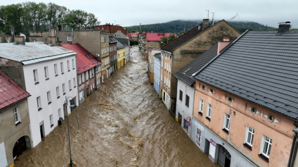
With typhoon Yagi battering Asia, storm Boris drenching parts of Europe, extreme flooding in the Sahel and hurricane Helene racing towards Florida, September so far has been a very wet month.
But while scientists can link some extreme weather events directly to human-caused global warming, it remains too early to draw clear conclusions about this sodden month.
"You will always have some sort of extreme weather events, but their intensity has been magnified by global warming, especially in the context of rainfall," Paulo Ceppi from Imperial College London's Grantham Institute told AFP on Thursday.
"That's probably one of the common drivers of these different events in very different parts of the world."
Early indications from monthly data show some record-breaking precipitation levels in the regions affected.
In central Europe, the torrential rains accompanying storm Boris were "the heaviest ever recorded" in the region, according to the World Weather Attribution (WWA) network of scientists, inundating homes and farmland.
Global warming has doubled the likelihood of severe four-day downpours since the pre-industrial era and the costs of climate change are "accelerating", WWA said in a report published Wednesday.
Meanwhile in Japan's city of Wajima, more than 120 millimetres (4.7 inches) of rainfall per hour from typhoon Yagi was recorded on the morning of September 21 -- the heaviest rain since comparative data became available in 1929.
- Hotter, and wetter? -
"Attributing different weather patterns around the world at the same time to climate change is very challenging," said Liz Stephens, science lead at the Red Cross Red Crescent Climate Centre.
"But the fundamental principle remains that for every 1 degree Celsius of warming the atmosphere can hold seven percent more moisture," she told AFP.
With global warming on track to exceed 1.5 degrees Celsius above pre-industrial times "you can do the math pretty quickly and that will have a measurable impact," said Ceppi from the Grantham Institute.
The 2024 northern summer saw the highest global temperatures ever recorded, beating last year's record, according to the EU's climate monitor Copernicus.
A hotter planet, in other words, could also signal a wetter one.
The sweltering summer in the Mediterranean this year "gives a lot of extra evaporation, pumping more water vapour into Europe if the conditions are right and allowing for all that moisture to be dumped in certain places," Ceppi said.
"The global temperatures -- both over the land and the ocean -- were anomalously high during August-September despite La Nina-like conditions evolving in the Pacific," Roxy Mathew Koll at the Indian Institute of Tropical Meteorology told AFP.
"Anomalously high temperatures assist in supplying additional heat and moisture for storms and weather systems to intensify."
La Nina refers to a naturally-occurring climate phenomenon that cools the ocean surface temperatures in large swathes of the tropical Pacific Ocean, coupled with winds, rains and changes in atmospheric pressure.
In many locations, especially in the tropics, La Nina produces the opposite climate impacts to El Nino, which heats up the surface of the oceans, leading to drought in some parts of the world and triggering heavy downpours elsewhere.
Currently, "neutral" conditions prevail, meaning neither El Nino nor La Nina are present.
Large swaths of South America and Southern Africa suffered from drought in 2024.
The global September update from Copernicus is due early next month and will provide hard data on precipitation levels.
T.Galgano--PV
