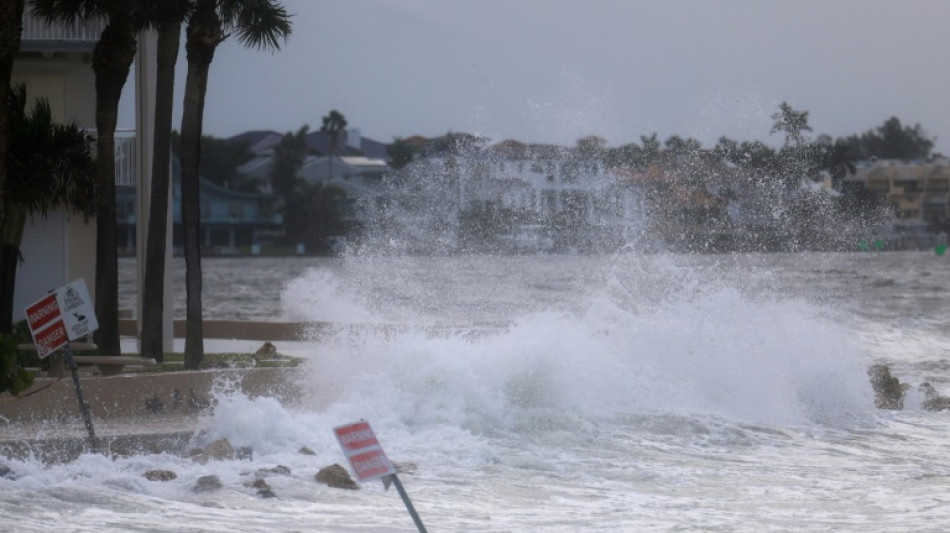
Florida bracing for 'unsurvivable' Hurricane Helene

Heavy rains and intensifying winds pummeled Florida as parts of the state braced for "unsurvivable" conditions ahead of Hurricane Helene's landfall later Thursday, with officials warning of a 20-foot (six-meter) storm surge that could submerge the low-lying coast.
Residents were making final preparations, loading up on gas and heeding mass evacuation orders ahead of the hurricane -- projected to be one of the largest Gulf of Mexico storms in decades.
Fast-moving Helene was upgraded Thursday afternoon to a "major" Category 3 hurricane, the National Hurricane Center (NHC) in Miami said.
It was packing winds of 120 miles (193 kilometers) per hour as it churned over the Gulf's warm waters, and "additional strengthening is expected before Helene makes landfall in the Florida Big Bend this evening," the NHC added.
Helene could roar ashore in the Big Bend coastal area south of Florida's capital city Tallahassee, in the dark, as an even stronger Category 4 storm.
The hurricane center minced no words, posting on X: "EVERYONE along the Florida Big Bend coast is at risk of potentially catastrophic storm surge."
Tampa and Tallahassee airports have closed, with parts of St. Petersburg, downtown Tampa, Sarasota, Treasure Island and other cities on Florida's west coast already flooded.
About 125,000 homes and businesses were without power.
"We're expecting to see a storm surge inundation of 15 to 20 feet above ground level," NHC director Mike Brennan said. "That's up to the top of a second story building. Again, a really unsurvivable scenario is going to play out here in this portion of the Florida coastline."
The accompanying waves "can destroy houses, move cars, and that water level is going to rise very quickly," Brennan added.
- Evacuate or hunker down? -
In Alligator Point, a coastal town on a picturesque peninsula in the storm's path, David Wesolowski was taking no chances.
"I just came to button up a few things before it gets too windy," the 37-year-old real estate agent told AFP as he boarded up his house on stilts.
"If it stays on course, this is going to look different afterwards, that's for sure," he said, before taking his family to higher ground in Tallahassee.
Meanwhile, Patrick Riickert refused to budge from his small wooden house in Crawfordville, a town of 5,000 people a few miles inland.
As in Alligator Point, most residents have bolted and it looked like a ghost town, but Riickert, his wife and five grandchildren were "not going anywhere," the 58-year-old insisted.
"I am going to hunker down" and ride out the hurricane, as he did in 2018 when deadly Hurricane Michael, a Category 5 megastorm, blew through the Florida panhandle.
The NHC warned of up to 20 inches (51 cm) of rain in some spots, and potentially life-threatening flooding as well as "numerous" landslides across the southern Appalachians.
Tornado warnings went out across northern Florida, Georgia and the Carolinas.
Georgia's sprawling capital Atlanta was forecast to experience tropical storm-force winds and flash flooding from up to 12 inches of rain.
And Tennessee -- more than 300 miles from the Gulf Coast -- braced for tropical storm conditions statewide.
- 'Life-threatening impacts' -
"This is going to be a multi-state event with the potential for significant impacts from Florida all the way to Tennessee," Federal Emergency Management Agency administrator Deanne Criswell told reporters at the White House after updating President Joe Biden.
"The president wants to make sure that everyone is paying attention to the potential life-threatening impacts that this storm may bring," she said.
Florida Governor Ron DeSantis mobilized the National Guard and ordered thousands of personnel in place for search-and-rescue operations and power restoration.
Helene could become the most powerful hurricane to hit the United States in over a year -- and almost certainly the biggest.
Researchers say climate change likely plays a role in the rapid intensification of hurricanes, because there is more energy in warmer oceans for them to feed on.
H.Ercolani--PV
